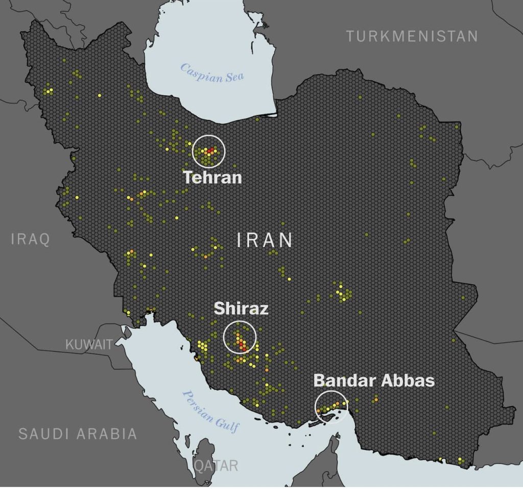
A satellite data analysis published on Friday revealed a broad picture of the damage inflicted on structures across Iran since the start of the U.S.-Israeli war. The assessment is among the most comprehensive so far in tracking sites that have been hit over recent days.
The findings showed that damage affected structures in more than one area, with a clear concentration in Tehran, the capital and Iran’s most populous city, as well as in the south-central city of Shiraz. In Bandar Abbas, the port city that hosts a major Iranian naval base, the analysis pointed to damage at more than 40 structures.
Details
Bandar Abbas carries added importance because it sits on the Strait of Hormuz, the passage through which roughly one-fifth of global oil supplies move, at a time when oil-laden tankers are backing up بسبب threats linked to possible Iranian attacks.
The Washington Post relied on a comparison of data from the Sentinel-1 satellite dating back to before the offensive began on February 28, with data collected between March 2 and March 10. The satellite uses radar technology to detect changes on the ground, including damage to or destruction of buildings.
But this type of analysis does not capture damage in agricultural, vegetated, or undeveloped areas, and it may also miss smaller-scale incidents. Even so, it gains added importance as access to high-resolution optical imagery has declined in recent days, after major U.S.-based providers imposed restrictions, alongside the broad internet shutdown inside Iran.
What next?
This analysis provides an important visual indicator of how far the strikes have spread across Iran, and it may become a key reference in estimating the scale of field damage if access to open imagery and information coming out of Iran remains restricted.
Source: The Washington Post